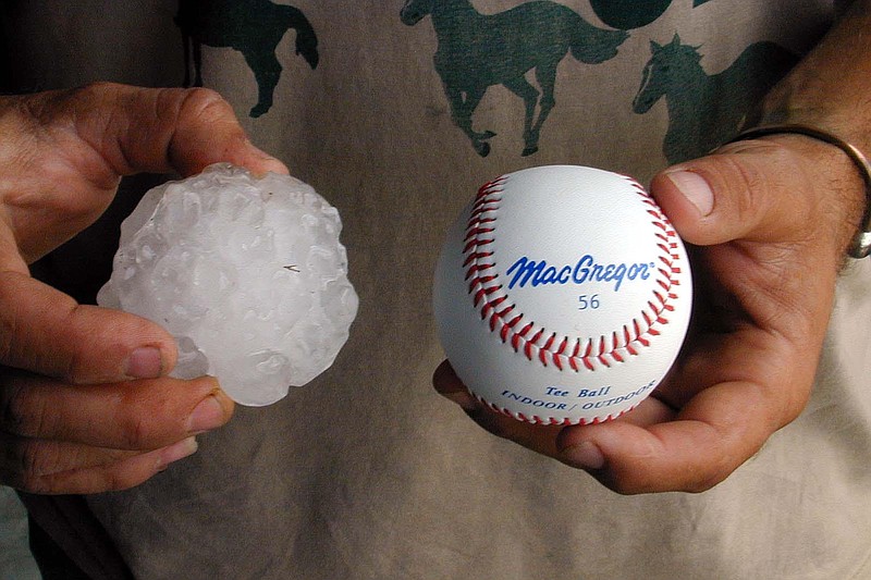
Storms crossing Arkansas on Wednesday night brought hail as large as baseballs to parts of the state, the National Weather Service Little Rock tweeted.
Around 5:55 p.m., people in the community of Royal in Garland County reported baseball-sized hail from a storm complex that was moving toward downtown Hot Springs, the tweet states.
The combination of hot humid air that feeds strong and sudden thunderstorms and cold dry air in the atmosphere helps make large hail out of the water created by the storm system, said Dennis Cavanaugh, warning coordination meteorologist for the weather service’s North Little Rock office.
“You need colder drier air sitting on top of hot humid air,” Cavanaugh said.
The severe thunderstorm warning for Hot Springs was lifted at 6:30 p.m., tweets from the weather agency showed, but warnings for Malvern, Sheridan and Haskell were in place until 7:15 p.m.
People in communities near Hot Springs reported hail falling that ranged from tennis ball to baseball sized, Cavanaugh said.
As of 6:50 p.m., the storm had passed into Grant County, with the largest concentration of hail in the southwest part of the county, Cavanaugh said.
The tweet warned that hail of this size can be deadly, and directed people to seek shelter inside until the storm passed.
This story has been updated. It was originally published at 7:46 p.m. under the headline "Baseball-sized hail reported in Garland County."